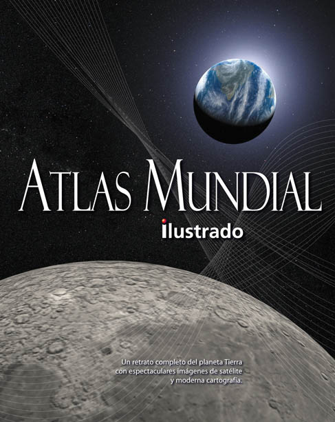
https://www.imosver.com/en/libros/atlas-mundial-ilustrado-08999900640899990064Atlas mundial ilustrado22.46El Atlas Mundial Ilustrado es una obra de consulta fundamental para la familia. Combina una sofisticada cartografía, creada recientemente para este Atlas, con cientos de fotografías, vistas satélite, https://static.imosver.com/imagenes_small/9788444/978844410048.jpgLibrosLibros/MAPASSin stockEVEREST000https://static.imosver.com/imagenes_small/9788444/978844410048.jpg23.6451.182006/11/119788444100487Jiménez Rioja, AlbertoLibrosaño_2006idioma_SpanishCformato_Tapa duraautor_Jiménez Rioja, Albertosaga_SIN COLECCION
Artículo
Atlas mundial ilustrado
Jiménez Rioja Alberto
EVEREST
MAPAS
Cookie notice
We use cookies to ensure you get the best experience on our site
Read cookie policy.
Manage cookie preferences
This type of cookie allows the user to browse a website, platform, or application and to use the different options or services that exist on it.
imosver_session
Description
Essential first-party cookie. It keeps your session identified while you browse: your basket, your language and access to your account. The website cannot work without it.
Duration
120 minutes
Facilities
Domain
imosver.com
OCT8NE
Description
This cookie is used for the proper functioning of the Oct8ne Chat to provide customer support service to the user.
These are those that enable the tracking and analysis of user behavior on our website. The information collected is used to measure user activity on the website and to create user browsing profiles.
_clsk
Description
Microsoft Clarity first-party cookie. It groups the pages you visit into a single session in order to analyse your journey through the website.
Duration
1 days
Facilities
Domain
imosver.com
logglytrackingsession
Description
Identifies and records the user session for analytical purposes.
Duration
Session
Facilities
Domain
.imosver.com
GOOGLE_ANALYTICS
Description
Records a unique identifier that is used to generate statistical data about how the visitor uses the website.
Duration
1 Year
Facilities
Domain
.imosver.com
_clck
Description
Microsoft Clarity first-party cookie. It stores an anonymous browser identifier so that visits to this website can be attributed to the same user and usage statistics can be produced.
Duration
1 Year
Facilities
Domain
imosver.com
CLID
Description
Microsoft Clarity third-party cookie. It identifies the first time Clarity detects this browser on any website using the service.
Duration
1 Year
Facilities
Domain
clarity.ms
_ga
Description
Google Analytics cookie. It stores an anonymous browser identifier in order to distinguish users and produce website usage statistics.
Duration
2 Year
Facilities
Domain
.imosver.com
_ga_LZR660YW0M
Description
Google Analytics 4 cookie. It keeps the analytics session state so that visits and the journey through the website can be measured.
Duration
2 Year
Facilities
Domain
.imosver.com
These are the ones that allow us to adapt the navigation on our website to your preferences (e.g., language, browser used, etc.).
_fbp
Description
Used by Facebook to offer a series of advertising products, such as real-time bids from third-party advertisers.
Duration
3 Month
Facilities
Domain
.imosver.com
afiliado
Description
First-party affiliate programme cookie. It stores for 30 days the code of the affiliate that brought you to the website, so that the sale can be attributed to them.
Duration
1 Month
Facilities
Domain
imosver.com
MUID
Description
Microsoft third-party cookie. It identifies unique browsers visiting Microsoft sites and is used for advertising, analytics and other operational purposes.
Duration
1 Year
Facilities
Domain
clarity.ms
ANONCHK
Description
Microsoft third-party cookie. It indicates whether the MUID identifier is transferred to ANID, a cookie used for advertising purposes.
Duration
10 minutes
Facilities
Domain
clarity.ms
MR
Description
Microsoft third-party cookie. It indicates whether the MUID identifier must be refreshed.
Duration
7 days
Facilities
Domain
clarity.ms
SM
Description
Microsoft third-party cookie. It synchronises the MUID identifier across Microsoft domains.
Duration
Session
Facilities
Domain
clarity.ms
_fbc
Description
Meta cookie. It stores the identifier of the Facebook or Instagram advert you arrived from, in order to attribute the visit to that advertising campaign.
Duration
3 Month
Facilities
Domain
.imosver.com
_gcl_au
Description
Google Ads cookie. It records a visit coming from an advert so that advertising campaign conversions can be measured.
Duration
3 Month
Facilities
Domain
.imosver.com
_uetsid
Description
Microsoft Advertising cookie. It identifies your browsing session in order to measure conversions from Bing advertising campaigns.
Duration
1 days
Facilities
Domain
.imosver.com
_uetvid
Description
Microsoft Advertising cookie. It identifies your browser across visits in order to measure conversions from Bing advertising campaigns.
El Atlas Mundial Ilustrado es una obra de consulta fundamental para la familia. Combina una sofisticada cartografía, creada recientemente para este Atlas, con cientos de fotografías, vistas satélite, ilustraciones, gráficos y tablas para documentar nuestro mundo como nunca antes se había hecho. Se introduce el Planeta Tierra con una visión general presentada a través de mapas temáticos detallados, tratando temas tan diversos como nuestro lugar en el espacio, clima, fauna y flora, distribución de los recursos, el progreso de los humanos, su estudio, población, religiones, indígenas, transporte y comunicación. En la parte central del Atlas hay más de sesenta mapas describiendo el paisaje de nuestro planeta. Cada continente está presentado por cuatro diferentes temáticas concentradas en las imágenes de satélite de la región, su tierra y su medio ambiente, su historia política y su estructura, y el impacto humano sobre el paisaje. Mapas regionales que presentan los rasgos de manera clara, precisa, y una cartografía completa y actualizada sustentada por fotografías, vistas tridimensionales e ilustraciones arquitectónicas. Junto con un informativo y accesible texto, cada sección proporciona unas espectaculares fotos de cada región. También se cuenta con detallados mapas de los cuatro océanos más grandes y de la Antártida. Complementando los mapas tenemos una extensa sección de consulta que incluye comparaciones geográficas, las banderas de todas las naciones, zonas horarias y un archivo de datos presentado en forma de tabla con las estadísticas fundamentales de todos los países del mundo así como un glosario, un extenso índice y un anexo.